INSPIRE ATOM Download Service from the Instituto Nacional de Estatística (INE) for the INSPIRE Theme Statistical Units INSPIRE Atom download service of geographic Data set from INE of the INSPIRE Statistical Units theme. The ATOM distribution format provides a simple mechanism,widely disseminated for the publication of information on the web in the form of "subscriptions" in a way compatible with the web architecture and many existing tools. In addition, ATOM is complemented, in the Implementation Rules for INSPIRE Spatial Data Services, by OpenSearch which provides a service-oriented interface to ATOM static documents http://id.igeo.pt/sdg/6d8fd6e9-f600-484c-991e-fc0cc2667311 No restrictions 2017-05-17T14:20:00Z Ana Santos ana.msantos@ine.pt Francisco Caldeira francisco.caldeira@ine.pt BGRI 2011 of the mainland Portugal http://id.igeo.pt/cdg/e1c137d1-794b-486b-ae73-8d5714f76484 https://inspire.ine.pt/SU/atom/BGRI2011Cont http://id.igeo.pt/cdg/e1c137d1-794b-486b-ae73-8d5714f76484 No restrictions 2019-11-11T12:00:00Z
BGRI 2011 of the mainland Portugal for download in GML format.
Geographic reference system supported in cartographic or ortho-photocartographic information in digital format,for the whole national territory.It allows the division of each basic administrative unit, the parish, into small statistical areas - sections and statistical subsections.

Available downloads: (media type application/application/x-gmz): ETRS89/TM06 ETRS89 WGS84 ETRS89/ETRS-LAEA
Metadata (Portuguese only): ISO 19139
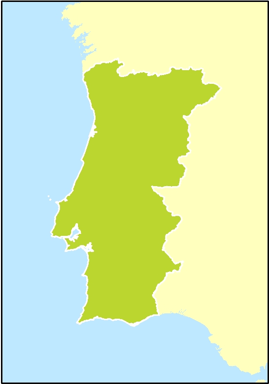
Base Geográfica de Referenciação da Informação 2011 ]]>
36.80 -10.132 36.80 -5.62 42.32 -5.62 42.32 -10.132 36.80 -10.132
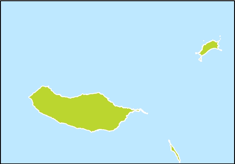
BGRI 2011 of the Autonomous Region of Madeira http://id.igeo.pt/cdg/da15ef97-30a1-4e88-a52c-9b7225e31f3e https://inspire.ine.pt/SU/atom/BGRI2011RAM http://id.igeo.pt/cdg/da15ef97-30a1-4e88-a52c-9b7225e31f3e No restrictions 2019-11-11T12:00:00Z
BGRI 2011 of the Autonomous Region of Madeira for download in GML format.
Geographic reference system supported in cartographic or ortho-photocartographic information in digital format,for the whole national territory.It allows the division of each basic administrative unit, the parish, into small statistical areas - sections and statistical subsections.

Available downloads: (media type application/application/x-gmz): PTRA08/UTM_zone_28N ETRS89 WGS84 ETRS89/ETRS-LAEA
Metadata (Portuguese only): ISO 19139
Base Geográfica de Referenciação da Informação 2011 ]]>
29.95 -17.55 29.95 -15.70 33.22 -15.70 33.22 -17.55 29.95 -17.55
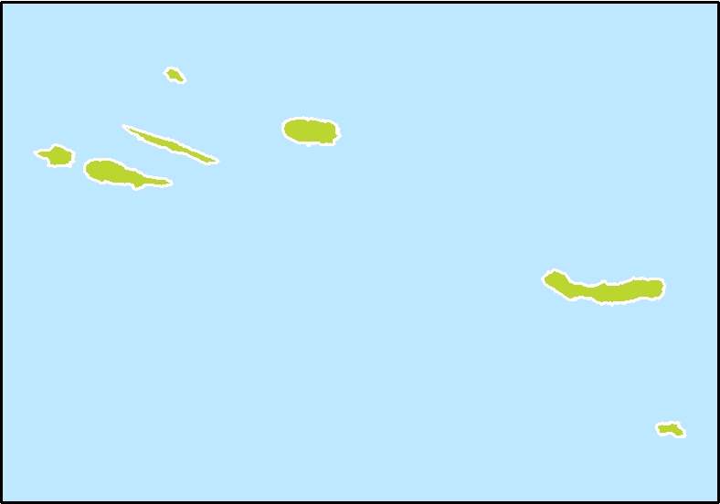
BGRI 2011 of the Autonomous Region of the Azores Central and Eastern Group http://id.igeo.pt/cdg/16129ac5-e07a-42a5-9d10-a302878144e0 https://inspire.ine.pt/SU/atom/BGRI2011RAAGCO http://id.igeo.pt/cdg/16129ac5-e07a-42a5-9d10-a302878144e0 No restrictions 2019-11-11T12:00:00Z
BGRI 2011 of the Autonomous Region of the Azores Central and Eastern Group for download in GML format.
Geographic reference system supported in cartographic or ortho-photocartographic information in digital format,for the whole national territory.It allows the division of each basic administrative unit, the parish, into small statistical areas - sections and statistical subsections.

Available downloads: (media type application/application/x-gmz): PTRA08/UTM_zone_26N ETRS89 WGS84 ETRS89/ETRS-LAEA
Metadata (Portuguese only): ISO 19139
Base Geográfica de Referenciação da Informação 2011 ]]>
36.72 -29.40 39.25 -29.40 39.25 -24.73 36.72 -24.73 36.72 -29.40
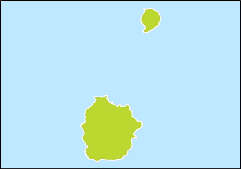
BGRI 2011 of the Autonomous Region of the Azores Western Group http://id.igeo.pt/cdg/0ce3debd-4031-48d8-b3bb-efbe226277da https://inspire.ine.pt/SU/atom/BGRI2011RAAGO http://id.igeo.pt/cdg/0ce3debd-4031-48d8-b3bb-efbe226277da No restrictions 2019-11-11T12:00:00Z
BGRI 2011 of the Autonomous Region of the Azores Western Group for download in GML format.
Geographic reference system supported in cartographic or ortho-photocartographic information in digital format,for the whole national territory.It allows the division of each basic administrative unit, the parish, into small statistical areas - sections and statistical subsections.

Available downloads: (media type application/application/x-gmz): PTRA08/UTM_zone_25N ETRS89 WGS84 ETRS89/ETRS-LAEA
Metadata (Portuguese only): ISO 19139
Base Geográfica de Referenciação da Informação 2011 ]]>
39.30 -31.36 39.75 -31.36 39.75 -31.00 39.30 -31.00 39.30 -31.36
BGRI 2001 of the mainland Portugal http://id.igeo.pt/cdg/8a87e19f-d9a8-444c-b27b-c42593944af1 https://inspire.ine.pt/SU/atom/BGRI2001Cont http://id.igeo.pt/cdg/8a87e19f-d9a8-444c-b27b-c42593944af1 No restrictions 2019-11-11T12:00:00Z
BGRI 2001 of the mainland Portugal for download in GML format.
Geographic reference system supported in cartographic or ortho-photocartographic information in digital format,for the whole national territory.It allows the division of each basic administrative unit, the parish, into small statistical areas - sections and statistical subsections.

Available downloads: (media type application/application/x-gmz): ETRS89/TM06 ETRS89 WGS84 ETRS89/ETRS-LAEA
Metadata (Portuguese only): ISO 19139
Base Geográfica de Referenciação da Informação 2001 ]]>
36.80 -10.132 36.80 -5.62 42.32 -5.62 42.32 -10.132 36.80 -10.132
BGRI 2001 of the Autonomous Region of Madeira http://id.igeo.pt/cdg/cd594978-8ca1-4339-bd59-ad210a5403c8 https://inspire.ine.pt/SU/atom/BGRI2001RAM http://id.igeo.pt/cdg/cd594978-8ca1-4339-bd59-ad210a5403c8 No restrictions 2019-11-11T12:00:00Z
BGRI 2001 of the Autonomous Region of Madeira for download in GML format.
Geographic reference system supported in cartographic or ortho-photocartographic information in digital format,for the whole national territory.It allows the division of each basic administrative unit, the parish, into small statistical areas - sections and statistical subsections.

Available downloads: (media type application/application/x-gmz): PTRA08/UTM_zone_28N ETRS89 WGS84 ETRS89/ETRS-LAEA
Metadata (Portuguese only): ISO 19139
Base Geográfica de Referenciação da Informação 2001 ]]>
29.95 -17.55 29.95 -15.70 33.22 -15.70 33.22 -17.55 29.95 -17.55
BGRI 2001 of the Autonomous Region of the Azores Central and Eastern Group http://id.igeo.pt/cdg/0f76ce2e-eff2-4eb1-9432-1397c0410fa5 https://inspire.ine.pt/SU/atom/BGRI2001RAAGCO http://id.igeo.pt/cdg/0f76ce2e-eff2-4eb1-9432-1397c0410fa5 No restrictions 2019-11-11T12:00:00Z
BGRI 2001 of the Autonomous Region of the Azores Central and Eastern Group for download in GML format.
Geographic reference system supported in cartographic or ortho-photocartographic information in digital format,for the whole national territory.It allows the division of each basic administrative unit, the parish, into small statistical areas - sections and statistical subsections.

Available downloads: (media type application/application/x-gmz): PTRA08/UTM_zone_26N ETRS89 WGS84 ETRS89/ETRS-LAEA
Metadata (Portuguese only): ISO 19139
Base Geográfica de Referenciação da Informação 2011 ]]>
36.72 -29.40 39.25 -29.40 39.25 -24.73 36.72 -24.73 36.72 -29.40
BGRI 2001 of the Autonomous Region of the Azores Western Group http://id.igeo.pt/cdg/cb5d4c1f-768c-4758-ba2c-d0e8e259d154 https://inspire.ine.pt/SU/atom/BGRI2001RAAGO http://id.igeo.pt/cdg/cb5d4c1f-768c-4758-ba2c-d0e8e259d154 No restrictions 2019-11-11T12:00:00Z
BGRI 2011 of the Autonomous Region of the Azores Western Group for download in GML format.
Geographic reference system supported in cartographic or ortho-photocartographic information in digital format,for the whole national territory.It allows the division of each basic administrative unit, the parish, into small statistical areas - sections and statistical subsections.

Available downloads: (media type application/application/x-gmz): PTRA08/UTM_zone_25N ETRS89 WGS84 ETRS89/ETRS-LAEA
Metadata (Portuguese only): ISO 19139
Base Geográfica de Referenciação da Informação 2011 ]]>
39.30 -31.36 39.75 -31.36 39.75 -31.00 39.30 -31.00 39.30 -31.36
BGRE 1991 of the mainland Portugal http://id.igeo.pt/cdg/c011ca27-6cea-4357-9dec-717056dda3b2 https://inspire.ine.pt/SU/atom/BGRE1991Cont http://id.igeo.pt/cdg/c011ca27-6cea-4357-9dec-717056dda3b2 No restrictions 2019-11-11T12:00:00Z
BGRE 1991 of the mainland Portugal for download in GML format.
Geographic reference system supported in cartographic or ortho-photocartographic information in digital format,for the whole national territory.It allows the division of each basic administrative unit, the parish, into small statistical areas - sections and statistical subsections.

Available downloads: (media type application/application/x-gmz): ETRS89/TM06 ETRS89 WGS84 ETRS89/ETRS-LAEA
Metadata (Portuguese only): ISO 19139
Base Geográfica de Referenciação Espacial 1991 ]]>
36.80 -10.132 36.80 -5.62 42.32 -5.62 42.32 -10.132 36.80 -10.132
BGRE 1991 of the Autonomous Region of Madeira http://id.igeo.pt/cdg/419c774d-9abc-4f7a-9abb-01dea68014c4 https://inspire.ine.pt/SU/atom/BGRE1991RAM http://id.igeo.pt/cdg/419c774d-9abc-4f7a-9abb-01dea68014c4 No restrictions 2019-11-11T12:00:00Z
BGRE 1991 of the Autonomous Region of Madeira for download in GML format.
Geographic reference system supported in cartographic or ortho-photocartographic information in digital format,for the whole national territory.It allows the division of each basic administrative unit, the parish, into small statistical areas - sections and statistical subsections.

Available downloads: (media type application/application/x-gmz): PTRA08/UTM_zone_28N ETRS89 WGS84 ETRS89/ETRS-LAEA
Metadata (Portuguese only): ISO 19139
Base Geográfica de Referenciação Espacial 1991 ]]>
29.95 -17.55 29.95 -15.70 33.22 -15.70 33.22 -17.55 29.95 -17.55
BGRE 1991 of the Autonomous Region of the Azores Central and Eastern Group http://id.igeo.pt/cdg/59fe8e9e-3007-4d92-bbf2-549565dbe411 https://inspire.ine.pt/SU/atom/BGRE1991RAAGCO http://id.igeo.pt/cdg/59fe8e9e-3007-4d92-bbf2-549565dbe411 No restrictions 2019-11-11T12:00:00Z
BGRE 1991 of the Autonomous Region of the Azores Central and Eastern Group for download in GML format.
Geographic reference system supported in cartographic or ortho-photocartographic information in digital format,for the whole national territory.It allows the division of each basic administrative unit, the parish, into small statistical areas - sections and statistical subsections.

Available downloads: (media type application/application/x-gmz): PTRA08/UTM_zone_26N ETRS89 WGS84 ETRS89/ETRS-LAEA
Metadata (Portuguese only): ISO 19139
Base Geográfica de Referenciação Espacial 1991 ]]>
36.72 -29.40 39.25 -29.40 39.25 -24.73 36.72 -24.73 36.72 -29.40
BGRE 1991 of the Autonomous Region of the Azores Western Group http://id.igeo.pt/cdg/0a0cc804-5fbd-4dc5-b6fb-e085822ae30e https://inspire.ine.pt/SU/atom/BGRE1991RAAGO http://id.igeo.pt/cdg/0a0cc804-5fbd-4dc5-b6fb-e085822ae30e No restrictions 2019-11-11T12:00:00Z
BGRE 1991 of the Autonomous Region of the Azores Western Group for download in GML format.
Geographic reference system supported in cartographic or ortho-photocartographic information in digital format,for the whole national territory.It allows the division of each basic administrative unit, the parish, into small statistical areas - sections and statistical subsections.

Available downloads: (media type application/application/x-gmz): PTRA08/UTM_zone_25N ETRS89 WGS84 ETRS89/ETRS-LAEA
Metadata (Portuguese only): ISO 19139
Base Geográfica de Referenciação Espacial 1991 ]]>
39.30 -31.36 39.75 -31.36 39.75 -31.00 39.30 -31.00 39.30 -31.36
Localities 2011 of the mainland Portugal http://id.igeo.pt/cdg/aa8109ee-0c4e-4c56-9f53-a0a736d4b9ce https://inspire.ine.pt/SU/atom/LUGARES2011RAM http://id.igeo.pt/cdg/0bd4df9a-938c-4476-a2fd-0dc48629466f No restrictions 2019-11-11T12:00:00Z
Localities 2011 of the mainland Portugal for download in GML format.
A population cluster with 10 or more residential dwellings and to which a distinct place name is attached, irrespective of whether it belongs to 1 or more parishes.Their limits, in case of difficulty in their clear identification, took into consideration the continuity of construction, that is to say the buildings that do not distance each other more than 200 meters.For this purpose, the discontinuity of construction was not considered motivated by interposing of communication routes, soccer fields, streets, gardens, etc.

Available downloads: (media type application/application/x-gmz): ETRS89/TM06 ETRS89 WGS84 ETRS89/ETRS-LAEA
Metadata (Portuguese only): ISO 19139
Localities 2011 ]]>
36.80 -10.132 36.80 -5.62 42.32 -5.62 42.32 -10.132 36.80 -10.132
Localities 2011 da Autonomous Region of Madeira http://id.igeo.pt/cdg/aa8109ee-0c4e-4c56-9f53-a0a736d4b9ce https://inspire.ine.pt/SU/atom/LUGARES2011RAAGCO http://id.igeo.pt/cdg/9dfe1658-553d-4af4-8696-01eabaf1bc6e No restrictions 2019-11-11T12:00:00Z
Localities 2011 da Autonomous Region of Madeira for download in GML format.
A population cluster with 10 or more residential dwellings and to which a distinct place name is attached, irrespective of whether it belongs to 1 or more parishes.Their limits, in case of difficulty in their clear identification, took into consideration the continuity of construction, that is to say the buildings that do not distance each other more than 200 meters.For this purpose, the discontinuity of construction was not considered motivated by interposing of communication routes, soccer fields, streets, gardens, etc.

Available downloads: (media type application/application/x-gmz): PTRA08/UTM_zone_28N ETRS89 WGS84 ETRS89/ETRS-LAEA
Metadata (Portuguese only): ISO 19139
Localities 2011 ]]>
29.95 -17.55 29.95 -15.70 33.22 -15.70 33.22 -17.55 29.95 -17.55
Localities 2011 of the Autonomous Region of the Azores Central and Eastern Group http://id.igeo.pt/cdg/aa8109ee-0c4e-4c56-9f53-a0a736d4b9ce https://inspire.ine.pt/SU/atom/LUGARES2011RAAGCO http://id.igeo.pt/cdg/aa8109ee-0c4e-4c56-9f53-a0a736d4b9ce No restrictions 2019-11-11T12:00:00Z
Localities 2011 of the Autonomous Region of the Azores Central and Eastern Group for download in GML format.
A population cluster with 10 or more residential dwellings and to which a distinct place name is attached, irrespective of whether it belongs to 1 or more parishes.Their limits, in case of difficulty in their clear identification, took into consideration the continuity of construction, that is to say the buildings that do not distance each other more than 200 meters.For this purpose, the discontinuity of construction was not considered motivated by interposing of communication routes, soccer fields, streets, gardens, etc.

Available downloads: (media type application/application/x-gmz): PTRA08/UTM_zone_26N ETRS89 WGS84 ETRS89/ETRS-LAEA
Metadata (Portuguese only): ISO 19139
Localities 2011 ]]>
36.72 -29.40 39.25 -29.40 39.25 -24.73 36.72 -24.73 36.72 -29.40
Localities 2011 of the Autonomous Region of the Azores Western Group http://id.igeo.pt/cdg/80c09533-4f32-4f3b-967f-915af356c7a8 https://inspire.ine.pt/SU/atom/LUGARES2011RAAGO http://id.igeo.pt/cdg/80c09533-4f32-4f3b-967f-915af356c7a8 No restrictions 2019-11-11T12:00:00Z
Localities 2011 of the Autonomous Region of the Azores Western Group for download in GML format.
A population cluster with 10 or more residential dwellings and to which a distinct place name is attached, irrespective of whether it belongs to 1 or more parishes.Their limits, in case of difficulty in their clear identification, took into consideration the continuity of construction, that is to say the buildings that do not distance each other more than 200 meters.For this purpose, the discontinuity of construction was not considered motivated by interposing of communication routes, soccer fields, streets, gardens, etc.

Available downloads: (media type application/application/x-gmz): PTRA08/UTM_zone_25N ETRS89 WGS84 ETRS89/ETRS-LAEA
Metadata (Portuguese only): ISO 19139
Localities 2011 ]]>
39.30 -31.36 39.75 -31.36 39.75 -31.00 39.30 -31.00 39.30 -31.36
Localities 2001 de mainland Portugal http://id.igeo.pt/cdg/16facce9-fb2c-4ae2-aff8-e2a5d8648e9c https://inspire.ine.pt/SU/atom/LUGARES2001Cont http://id.igeo.pt/cdg/16facce9-fb2c-4ae2-aff8-e2a5d8648e9c No restrictions 2019-11-11T12:00:00Z
Localities 2001 de mainland Portugal for download in GML format.
A population cluster with 10 or more residential dwellings and to which a distinct place name is attached, irrespective of whether it belongs to 1 or more parishes.Their limits, in case of difficulty in their clear identification, took into consideration the continuity of construction, that is to say the buildings that do not distance each other more than 200 meters.For this purpose, the discontinuity of construction was not considered motivated by interposing of communication routes, soccer fields, streets, gardens, etc.

Available downloads: (media type application/application/x-gmz): ETRS89/TM06 ETRS89 WGS84 ETRS89/ETRS-LAEA
Metadata (Portuguese only): ISO 19139
Localities 2001 ]]>
36.80 -10.132 36.80 -5.62 42.32 -5.62 42.32 -10.132 36.80 -10.132
Localities 2001 da Autonomous Region of Madeira http://id.igeo.pt/cdg/371360d2-cf3f-4233-a19a-a73c2676256a https://inspire.ine.pt/SU/atom/LUGARES2001RAM http://id.igeo.pt/cdg/371360d2-cf3f-4233-a19a-a73c2676256a No restrictions 2019-11-11T12:00:00Z
Localities 2001 da Autonomous Region of Madeira for download in GML format.
A population cluster with 10 or more residential dwellings and to which a distinct place name is attached, irrespective of whether it belongs to 1 or more parishes.Their limits, in case of difficulty in their clear identification, took into consideration the continuity of construction, that is to say the buildings that do not distance each other more than 200 meters.For this purpose, the discontinuity of construction was not considered motivated by interposing of communication routes, soccer fields, streets, gardens, etc.

Available downloads: (media type application/application/x-gmz): PTRA08/UTM_zone_28N ETRS89 WGS84 ETRS89/ETRS-LAEA
Metadata (Portuguese only): ISO 19139
Localities 2001 ]]>
29.95 -17.55 29.95 -15.70 33.22 -15.70 33.22 -17.55 29.95 -17.55
Localities 2001 of the Autonomous Region of the Azores Central and Eastern Group http://id.igeo.pt/cdg/57cfd4ff-c58d-4530-b492-950c3a7b0905 https://inspire.ine.pt/SU/atom/LUGARES2001RAAGCO http://id.igeo.pt/cdg/57cfd4ff-c58d-4530-b492-950c3a7b0905 No restrictions 2019-11-11T12:00:00Z
Localities 2001 of the Autonomous Region of the Azores Central and Eastern Group for download in GML format.
A population cluster with 10 or more residential dwellings and to which a distinct place name is attached, irrespective of whether it belongs to 1 or more parishes.Their limits, in case of difficulty in their clear identification, took into consideration the continuity of construction, that is to say the buildings that do not distance each other more than 200 meters.For this purpose, the discontinuity of construction was not considered motivated by interposing of communication routes, soccer fields, streets, gardens, etc.

Available downloads: (media type application/application/x-gmz): PTRA08/UTM_zone_26N ETRS89 WGS84 ETRS89/ETRS-LAEA
Metadata (Portuguese only): ISO 19139
Localities 2001 ]]>
36.72 -29.40 39.25 -29.40 39.25 -24.73 36.72 -24.73 36.72 -29.40
Localities 2001 of the Autonomous Region of the Azores Western Group http://id.igeo.pt/cdg/57379ca4-1fd3-4242-82be-f10412069144 https://inspire.ine.pt/SU/atom/LUGARES2001RAAGO http://id.igeo.pt/cdg/57379ca4-1fd3-4242-82be-f10412069144 No restrictions 2019-11-11T12:00:00Z
Localities 2001 of the Autonomous Region of the Azores Western Group for download in GML format.
A population cluster with 10 or more residential dwellings and to which a distinct place name is attached, irrespective of whether it belongs to 1 or more parishes.Their limits, in case of difficulty in their clear identification, took into consideration the continuity of construction, that is to say the buildings that do not distance each other more than 200 meters.For this purpose, the discontinuity of construction was not considered motivated by interposing of communication routes, soccer fields, streets, gardens, etc.

Available downloads: (media type application/application/x-gmz): PTRA08/UTM_zone_25N ETRS89 WGS84 ETRS89/ETRS-LAEA
Metadata (Portuguese only): ISO 19139
Localities 2001 ]]>
39.30 -31.36 39.75 -31.36 39.75 -31.00 39.30 -31.00 39.30 -31.36
Localities 1991 de mainland Portugal http://id.igeo.pt/cdg/b1c9b4bf-df0c-40bb-8bd0-e928f15a111e https://inspire.ine.pt/SU/atom/LUGARES1991Cont http://id.igeo.pt/cdg/b1c9b4bf-df0c-40bb-8bd0-e928f15a111e No restrictions 2019-11-11T12:00:00Z
Localities 1991 de mainland Portugal for download in GML format.
A population cluster with 10 or more residential dwellings and to which a distinct place name is attached, irrespective of whether it belongs to 1 or more parishes.Their limits, in case of difficulty in their clear identification, took into consideration the continuity of construction, that is to say the buildings that do not distance each other more than 200 meters.For this purpose, the discontinuity of construction was not considered motivated by interposing of communication routes, soccer fields, streets, gardens, etc.

Available downloads: (media type application/application/x-gmz): ETRS89/TM06 ETRS89 WGS84 ETRS89/ETRS-LAEA
Metadata (Portuguese only): ISO 19139
Localities 1991 ]]>
36.80 -10.132 36.80 -5.62 42.32 -5.62 42.32 -10.132 36.80 -10.132
Localities 1991 da Autonomous Region of Madeira http://id.igeo.pt/cdg/3fc0ed25-28ac-4320-a275-80e9c0eb6433 https://inspire.ine.pt/SU/atom/LUGARES1991RAM http://id.igeo.pt/cdg/3fc0ed25-28ac-4320-a275-80e9c0eb6433 No restrictions 2019-11-11T12:00:00Z
Localities 1991 da Autonomous Region of Madeira for download in GML format.
A population cluster with 10 or more residential dwellings and to which a distinct place name is attached, irrespective of whether it belongs to 1 or more parishes.Their limits, in case of difficulty in their clear identification, took into consideration the continuity of construction, that is to say the buildings that do not distance each other more than 200 meters.For this purpose, the discontinuity of construction was not considered motivated by interposing of communication routes, soccer fields, streets, gardens, etc.

Available downloads: (media type application/application/x-gmz): PTRA08/UTM_zone_28N ETRS89 WGS84 ETRS89/ETRS-LAEA
Metadata (Portuguese only): ISO 19139
Localities 1991 ]]>
29.95 -17.55 29.95 -15.70 33.22 -15.70 33.22 -17.55 29.95 -17.55
Localities 1991 of the Autonomous Region of the Azores Central and Eastern Group http://id.igeo.pt/cdg/9a242bc1-adce-40c3-9bf6-14b5e4926c53 https://inspire.ine.pt/SU/atom/LUGARES1991RAAGCO http://id.igeo.pt/cdg/9a242bc1-adce-40c3-9bf6-14b5e4926c53 No restrictions 2019-11-11T12:00:00Z
Localities 1991 of the Autonomous Region of the Azores Central and Eastern Group for download in GML format.
A population cluster with 10 or more residential dwellings and to which a distinct place name is attached, irrespective of whether it belongs to 1 or more parishes.Their limits, in case of difficulty in their clear identification, took into consideration the continuity of construction, that is to say the buildings that do not distance each other more than 200 meters.For this purpose, the discontinuity of construction was not considered motivated by interposing of communication routes, soccer fields, streets, gardens, etc.

Available downloads: (media type application/application/x-gmz): PTRA08/UTM_zone_26N ETRS89 WGS84 ETRS89/ETRS-LAEA
Metadata (Portuguese only): ISO 19139
Localities 1991 ]]>
36.72 -29.40 39.25 -29.40 39.25 -24.73 36.72 -24.73 36.72 -29.40
Localities 1991 of the Autonomous Region of the Azores Western Group http://id.igeo.pt/cdg/fffba73c-d048-4f61-8982-7b2b154fbbae https://inspire.ine.pt/SU/atom/LUGARES1991RAAGO http://id.igeo.pt/cdg/fffba73c-d048-4f61-8982-7b2b154fbbae No restrictions 2019-11-11T12:00:00Z
Localities 1991 of the Autonomous Region of the Azores Western Group for download in GML format.
A population cluster with 10 or more residential dwellings and to which a distinct place name is attached, irrespective of whether it belongs to 1 or more parishes.Their limits, in case of difficulty in their clear identification, took into consideration the continuity of construction, that is to say the buildings that do not distance each other more than 200 meters.For this purpose, the discontinuity of construction was not considered motivated by interposing of communication routes, soccer fields, streets, gardens, etc.

Available downloads: (media type application/application/x-gmz): PTRA08/UTM_zone_25N ETRS89 WGS84 ETRS89/ETRS-LAEA
Metadata (Portuguese only): ISO 19139
Localities 1991 ]]>
39.30 -31.36 39.75 -31.36 39.75 -31.00 39.30 -31.00 39.30 -31.36
NUTSI 2013 of the mainland Portugal http://id.igeo.pt/cdg/56e60815-c164-44a4-9204-3534ce43b024 https://inspire.ine.pt/SU/atom/NUTSI2013Cont http://id.igeo.pt/cdg/56e60815-c164-44a4-9204-3534ce43b024 No restrictions 2019-11-11T12:00:00Z
NUTSI 2013 of the mainland Portugal for download in GML format.
The Nomenclature of Territorial Units for Statistical Purposes (NUTS) was created by EUROSTAT with the National Statistical Institutes of the different European Union (EU) countries for the statistical analysis of data, based on a coherent and structured division of the Community economic territory. NUTS consists of hierarchical levels (NUTS I, II and III), supporting the whole collection, organization and dissemination of harmonized regional statistical information at European level. NUTS is also a reference for determining the eligibility of European regions for EU Cohesion Policy.

Available downloads: (media type application/application/x-gmz): ETRS89/TM06 ETRS89 WGS84 ETRS89/ETRS-LAEA
Metadata (Portuguese only): ISO 19139
NUTSI 2013 ]]>
36.80 -10.132 36.80 -5.62 42.32 -5.62 42.32 -10.132 36.80 -10.132
NUTSI 2013 da Autonomous Region of Madeira http://id.igeo.pt/cdg/2a6b954c-80be-47f1-8a78-588e01b79f4b https://inspire.ine.pt/SU/atom/NUTSI2013RAM http://id.igeo.pt/cdg/2a6b954c-80be-47f1-8a78-588e01b79f4b No restrictions 2019-11-11T12:00:00Z
NUTSI 2013 da Autonomous Region of Madeira for download in GML format.
The Nomenclature of Territorial Units for Statistical Purposes (NUTS) was created by EUROSTAT with the National Statistical Institutes of the different European Union (EU) countries for the statistical analysis of data, based on a coherent and structured division of the Community economic territory. NUTS consists of hierarchical levels (NUTS I, II and III), supporting the whole collection, organization and dissemination of harmonized regional statistical information at European level. NUTS is also a reference for determining the eligibility of European regions for EU Cohesion Policy.

Available downloads: (media type application/application/x-gmz): PTRA08/UTM_zone_28N ETRS89 WGS84 ETRS89/ETRS-LAEA
Metadata (Portuguese only): ISO 19139
NUTSI 2013 ]]>
29.95 -17.55 29.95 -15.70 33.22 -15.70 33.22 -17.55 29.95 -17.55
NUTSI 2013 of the Autonomous Region of the Azores Central and Eastern Group http://id.igeo.pt/cdg/9f1548d8-e5ba-47ac-b928-b890c9de700f https://inspire.ine.pt/SU/atom/NUTSI2013RAAGCO http://id.igeo.pt/cdg/9f1548d8-e5ba-47ac-b928-b890c9de700f No restrictions 2019-11-11T12:00:00Z
NUTSI 2013 of the Autonomous Region of the Azores Central and Eastern Group for download in GML format.
The Nomenclature of Territorial Units for Statistical Purposes (NUTS) was created by EUROSTAT with the National Statistical Institutes of the different European Union (EU) countries for the statistical analysis of data, based on a coherent and structured division of the Community economic territory. NUTS consists of hierarchical levels (NUTS I, II and III), supporting the whole collection, organization and dissemination of harmonized regional statistical information at European level. NUTS is also a reference for determining the eligibility of European regions for EU Cohesion Policy.

Available downloads: (media type application/application/x-gmz): PTRA08/UTM_zone_26N ETRS89 WGS84 ETRS89/ETRS-LAEA
Metadata (Portuguese only): ISO 19139
NUTSI 2013 ]]>
36.72 -29.40 39.25 -29.40 39.25 -24.73 36.72 -24.73 36.72 -29.40
NUTSI 2013 of the Autonomous Region of the Azores Western Group http://id.igeo.pt/cdg/2aaa38d6-c796-4f9a-a24c-fde5d5db7e9f https://inspire.ine.pt/SU/atom/NUTSI2013RAAGO http://id.igeo.pt/cdg/2aaa38d6-c796-4f9a-a24c-fde5d5db7e9f No restrictions 2019-11-11T12:00:00Z
NUTSI 2013 of the Autonomous Region of the Azores Western Group for download in GML format.
The Nomenclature of Territorial Units for Statistical Purposes (NUTS) was created by EUROSTAT with the National Statistical Institutes of the different European Union (EU) countries for the statistical analysis of data, based on a coherent and structured division of the Community economic territory. NUTS consists of hierarchical levels (NUTS I, II and III), supporting the whole collection, organization and dissemination of harmonized regional statistical information at European level. NUTS is also a reference for determining the eligibility of European regions for EU Cohesion Policy.

Available downloads: (media type application/application/x-gmz): PTRA08/UTM_zone_25N ETRS89 WGS84 ETRS89/ETRS-LAEA
Metadata (Portuguese only): ISO 19139
NUTSI 2013 ]]>
39.30 -31.36 39.75 -31.36 39.75 -31.00 39.30 -31.00 39.30 -31.36
NUTSII 2013 of the mainland Portugal http://id.igeo.pt/cdg/25400c88-f7f4-4ff0-a6fb-8c0bb188752d https://inspire.ine.pt/SU/atom/NUTSII2013Cont http://id.igeo.pt/cdg/25400c88-f7f4-4ff0-a6fb-8c0bb188752d No restrictions 2019-11-11T12:00:00Z
NUTSII 2013 of the mainland Portugal for download in GML format.
The Nomenclature of Territorial Units for Statistical Purposes (NUTS) was created by EUROSTAT with the National Statistical Institutes of the different European Union (EU) countries for the statistical analysis of data, based on a coherent and structured division of the Community economic territory. NUTS consists of hierarchical levels (NUTS I, II and III), supporting the whole collection, organization and dissemination of harmonized regional statistical information at European level. NUTS is also a reference for determining the eligibility of European regions for EU Cohesion Policy.

Available downloads: (media type application/application/x-gmz): ETRS89/TM06 ETRS89 WGS84 ETRS89/ETRS-LAEA
Metadata (Portuguese only): ISO 19139
NUTSII 2013 ]]>
36.80 -10.132 36.80 -5.62 42.32 -5.62 42.32 -10.132 36.80 -10.132
NUTSII 2013 da Autonomous Region of Madeira http://id.igeo.pt/cdg/feb257b6-acea-49e3-8c6c-7ce6aef09d3e https://inspire.ine.pt/SU/atom/NUTSII2013RAM http://id.igeo.pt/cdg/feb257b6-acea-49e3-8c6c-7ce6aef09d3e No restrictions 2019-11-11T12:00:00Z
NUTSII 2013 da Autonomous Region of Madeira for download in GML format.
The Nomenclature of Territorial Units for Statistical Purposes (NUTS) was created by EUROSTAT with the National Statistical Institutes of the different European Union (EU) countries for the statistical analysis of data, based on a coherent and structured division of the Community economic territory. NUTS consists of hierarchical levels (NUTS I, II and III), supporting the whole collection, organization and dissemination of harmonized regional statistical information at European level. NUTS is also a reference for determining the eligibility of European regions for EU Cohesion Policy.

Available downloads: (media type application/application/x-gmz): PTRA08/UTM_zone_28N ETRS89 WGS84 ETRS89/ETRS-LAEA
Metadata (Portuguese only): ISO 19139
NUTSII 2013 ]]>
29.95 -17.55 29.95 -15.70 33.22 -15.70 33.22 -17.55 29.95 -17.55
NUTSII 2013 of the Autonomous Region of the Azores Central and Eastern Group http://id.igeo.pt/cdg/84bededd-c64c-4a83-8526-7b4b73cb1b7f https://inspire.ine.pt/SU/atom/NUTSII2013RAAGCO http://id.igeo.pt/cdg/84bededd-c64c-4a83-8526-7b4b73cb1b7f No restrictions 2019-11-11T12:00:00Z
NUTSII 2013 of the Autonomous Region of the Azores Central and Eastern Group for download in GML format.
The Nomenclature of Territorial Units for Statistical Purposes (NUTS) was created by EUROSTAT with the National Statistical Institutes of the different European Union (EU) countries for the statistical analysis of data, based on a coherent and structured division of the Community economic territory. NUTS consists of hierarchical levels (NUTS I, II and III), supporting the whole collection, organization and dissemination of harmonized regional statistical information at European level. NUTS is also a reference for determining the eligibility of European regions for EU Cohesion Policy.

Available downloads: (media type application/application/x-gmz): PTRA08/UTM_zone_26N ETRS89 WGS84 ETRS89/ETRS-LAEA
Metadata (Portuguese only): ISO 19139
NUTSII 2013 ]]>
36.72 -29.40 39.25 -29.40 39.25 -24.73 36.72 -24.73 36.72 -29.40
NUTSII 2013 of the Autonomous Region of the Azores Western Group http://id.igeo.pt/cdg/fe509532-beda-4a08-972e-92375a626524 https://inspire.ine.pt/SU/atom/NUTSII2013RAAGO http://id.igeo.pt/cdg/fe509532-beda-4a08-972e-92375a626524 No restrictions 2019-11-11T12:00:00Z
NUTSII 2013 of the Autonomous Region of the Azores Western Group for download in GML format.
The Nomenclature of Territorial Units for Statistical Purposes (NUTS) was created by EUROSTAT with the National Statistical Institutes of the different European Union (EU) countries for the statistical analysis of data, based on a coherent and structured division of the Community economic territory. NUTS consists of hierarchical levels (NUTS I, II and III), supporting the whole collection, organization and dissemination of harmonized regional statistical information at European level. NUTS is also a reference for determining the eligibility of European regions for EU Cohesion Policy.

Available downloads: (media type application/application/x-gmz): PTRA08/UTM_zone_25N ETRS89 WGS84 ETRS89/ETRS-LAEA
Metadata (Portuguese only): ISO 19139
NUTSII 2013 ]]>
39.30 -31.36 39.75 -31.36 39.75 -31.00 39.30 -31.00 39.30 -31.36
NUTSIII 2013 of the mainland Portugal http://id.igeo.pt/cdg/6699a9ef-164e-48fe-b21d-0575fbdf52b7 https://inspire.ine.pt/SU/atom/NUTSIII2013Cont http://id.igeo.pt/cdg/6699a9ef-164e-48fe-b21d-0575fbdf52b7 No restrictions 2019-11-11T12:00:00Z
NUTSIII 2013 of the mainland Portugal for download in GML format.
The Nomenclature of Territorial Units for Statistical Purposes (NUTS) was created by EUROSTAT with the National Statistical Institutes of the different European Union (EU) countries for the statistical analysis of data, based on a coherent and structured division of the Community economic territory. NUTS consists of hierarchical levels (NUTS I, II and III), supporting the whole collection, organization and dissemination of harmonized regional statistical information at European level. NUTS is also a reference for determining the eligibility of European regions for EU Cohesion Policy.

Available downloads: (media type application/application/x-gmz): ETRS89/TM06 ETRS89 WGS84 ETRS89/ETRS-LAEA
Metadata (Portuguese only): ISO 19139
NUTSII 2013 ]]>
36.80 -10.132 36.80 -5.62 42.32 -5.62 42.32 -10.132 36.80 -10.132
NUTSIII 2013 da Autonomous Region of Madeira http://id.igeo.pt/cdg/9af420aa-102c-42e4-a561-86631e0e936e https://inspire.ine.pt/SU/atom/NUTSIII2013RAM http://id.igeo.pt/cdg/9af420aa-102c-42e4-a561-86631e0e936e No restrictions 2019-11-11T12:00:00Z
NUTSIII 2013 da Autonomous Region of Madeira for download in GML format.
The Nomenclature of Territorial Units for Statistical Purposes (NUTS) was created by EUROSTAT with the National Statistical Institutes of the different European Union (EU) countries for the statistical analysis of data, based on a coherent and structured division of the Community economic territory. NUTS consists of hierarchical levels (NUTS I, II and III), supporting the whole collection, organization and dissemination of harmonized regional statistical information at European level. NUTS is also a reference for determining the eligibility of European regions for EU Cohesion Policy.

Available downloads: (media type application/application/x-gmz): PTRA08/UTM_zone_28N ETRS89 WGS84 ETRS89/ETRS-LAEA
Metadata (Portuguese only): ISO 19139
NUTSIII 2013 ]]>
29.95 -17.55 29.95 -15.70 33.22 -15.70 33.22 -17.55 29.95 -17.55
NUTSIII 2013 of the Autonomous Region of the Azores Central and Eastern Group http://id.igeo.pt/cdg/63153e85-9427-4e0b-8db9-ea13d35a9ca9 https://inspire.ine.pt/SU/atom/NUTSIII2013RAAGCO http://id.igeo.pt/cdg/63153e85-9427-4e0b-8db9-ea13d35a9ca9 No restrictions 2019-11-11T12:00:00Z
NUTSIII 2013 of the Autonomous Region of the Azores Central and Eastern Group for download in GML format.
The Nomenclature of Territorial Units for Statistical Purposes (NUTS) was created by EUROSTAT with the National Statistical Institutes of the different European Union (EU) countries for the statistical analysis of data, based on a coherent and structured division of the Community economic territory. NUTS consists of hierarchical levels (NUTS I, II and III), supporting the whole collection, organization and dissemination of harmonized regional statistical information at European level. NUTS is also a reference for determining the eligibility of European regions for EU Cohesion Policy.

Available downloads: (media type application/application/x-gmz): PTRA08/UTM_zone_26N ETRS89 WGS84 ETRS89/ETRS-LAEA
Metadata (Portuguese only): ISO 19139
NUTSIII 2013 ]]>
36.72 -29.40 39.25 -29.40 39.25 -24.73 36.72 -24.73 36.72 -29.40
NUTSIII 2013 of the Autonomous Region of the Azores Western Group http://id.igeo.pt/cdg/a970e8c5-0c9c-43bf-b3c2-cbbae0af942b https://inspire.ine.pt/SU/atom/NUTSIII2013RAAGO http://id.igeo.pt/cdg/a970e8c5-0c9c-43bf-b3c2-cbbae0af942b No restrictions 2019-11-11T12:00:00Z
NUTSIII 2013 of the Autonomous Region of the Azores Western Group for download in GML format.
The Nomenclature of Territorial Units for Statistical Purposes (NUTS) was created by EUROSTAT with the National Statistical Institutes of the different European Union (EU) countries for the statistical analysis of data, based on a coherent and structured division of the Community economic territory. NUTS consists of hierarchical levels (NUTS I, II and III), supporting the whole collection, organization and dissemination of harmonized regional statistical information at European level. NUTS is also a reference for determining the eligibility of European regions for EU Cohesion Policy.

Available downloads: (media type application/application/x-gmz): PTRA08/UTM_zone_25N ETRS89 WGS84 ETRS89/ETRS-LAEA
Metadata (Portuguese only): ISO 19139
NUTSII 2013 ]]>
39.30 -31.36 39.75 -31.36 39.75 -31.00 39.30 -31.00 39.30 -31.36
GRID ETRS89 LAEA 1K of Portugal http://id.igeo.pt/cdg/1f427a5a-8e11-4cea-814b-ba09288346b5 https://inspire.ine.pt/SU/atom/GRIDPT http://id.igeo.pt/cdg/1f427a5a-8e11-4cea-814b-ba09288346b5 No restrictions 2019-11-11T12:00:00Z
GRID ETRS89 LAEA 1K of Portugal for download in GML format.
1x1 km grid (harmonized quadrangular mesh with dimension and georeferenced cell normalized) for Portugal (http://inspire.ec.europa.eu/theme/gg)

Available downloads: (media type application/application/x-gmz): ETRS89 WGS84 ETRS89/ETRS-LAEA
Metadata (Portuguese only): ISO 19139
GRID ETRS89 LAEA 1K ]]>
36.80 -10.132 36.80 -5.62 42.32 -5.62 42.32 -10.132 36.80 -10.132
Statistical Cities 2014 of the mainland Portugal http://id.igeo.pt/cdg/ebd6fc2f-d679-4c58-92f6-0e1b941fceac https://inspire.ine.pt/SU/atom/CIDADES2014Cont http://id.igeo.pt/cdg/ebd6fc2f-d679-4c58-92f6-0e1b941fceac No restrictions 2019-11-11T12:00:00Z
Statistical Cities 2014 of the mainland Portugal for download in GML format.
Territorial unit that corresponds to the adjustment of the urban perimeter, defined in the legal instruments of soils occupation for the settlements with category of city, to the perimeter of the statistical subsections used by INE in the Base Geográfica de Referenciação da Informação (BGRI).

Available downloads: (media type application/application/x-gmz): ETRS89/TM06 ETRS89 WGS84 ETRS89/ETRS-LAEA
Metadata (Portuguese only): ISO 19139
Statistical Cities 2014 ]]>
36.80 -10.132 36.80 -5.62 42.32 -5.62 42.32 -10.132 36.80 -10.132
Statistical Cities 2014 of the Autonomous Region of Madeira http://id.igeo.pt/cdg/85250be0-608b-4e91-9f77-92e7f5739f6b https://inspire.ine.pt/SU/atom/CIDADES2014RAM http://id.igeo.pt/cdg/85250be0-608b-4e91-9f77-92e7f5739f6b No restrictions 2019-11-11T12:00:00Z
Statistical Cities 2014 of the Autonomous Region of Madeira for download in GML format.
Territorial unit that corresponds to the adjustment of the urban perimeter, defined in the legal instruments of soils occupation for the settlements with category of city, to the perimeter of the statistical subsections used by INE in the Base Geográfica de Referenciação da Informação (BGRI).

Available downloads: (media type application/application/x-gmz): PTRA08/UTM_zone_28N ETRS89 WGS84 ETRS89/ETRS-LAEA
Metadata (Portuguese only): ISO 19139
Statistical Cities 2014 ]]>
29.95 -17.55 29.95 -15.70 33.22 -15.70 33.22 -17.55 29.95 -17.55
Statistical Cities 2014 of the Autonomous Region of the Azores Central and Eastern Group http://id.igeo.pt/cdg/9034a520-8544-444e-b77d-d4de3ef4133c https://inspire.ine.pt/SU/atom/CIDADES2014RAAGCO http://id.igeo.pt/cdg/9034a520-8544-444e-b77d-d4de3ef4133c No restrictions 2019-11-11T12:00:00Z
Statistical Cities 2014 of the Autonomous Region of the Azores Central and Eastern Group for download in GML format.
Territorial unit that corresponds to the adjustment of the urban perimeter, defined in the legal instruments of soils occupation for the settlements with category of city, to the perimeter of the statistical subsections used by INE in the Base Geográfica de Referenciação da Informação (BGRI).

Available downloads: (media type application/application/x-gmz): PTRA08/UTM_zone_26N ETRS89 WGS84 ETRS89/ETRS-LAEA
Metadata (Portuguese only): ISO 19139
Cidades estatísticas 2014 ]]>
36.72 -29.40 39.25 -29.40 39.25 -24.73 36.72 -24.73 36.72 -29.40